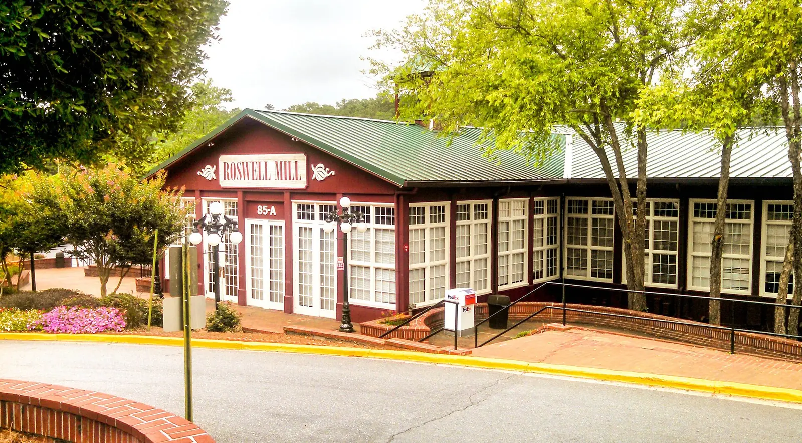
Ten Roswell areas from the city's plans, with each area's ZIP code, zoned high school and August 2026 Zillow home value, and a map.
Last checked Oct. 5, 2026. Sources: the City of Roswell’s 2045 Comprehensive Growth Plan (PDF), 2040 Comprehensive Plan (PDF) and character areas map layer, Fulton County Schools address map data and 2025-26 zone map, the state’s 2025 School Grades data, Zillow Research, the Census Bureau, MARTA and OpenStreetMap.
Roswell has no official list of neighborhoods with legal boundaries. What it has are plans. The city’s 2045 Comprehensive Growth Plan, which the mayor and council have approved for regional and state review, names five Activity Centers where it expects growth, and its map of character areas sorts the rest of the city into residential types. This guide uses those five centers and five residential areas that the city’s plans or OpenStreetMap name, so that every address in Roswell falls in one of 10 areas, each with its own page.
What this means for you
- Find your schools: zones do not follow area or city lines. Use the district’s Find Your School lookup.
- Check the city line: a mailing address that says Roswell can be in Milton, Alpharetta or unincorporated land, and the reverse. The parcel record with the Fulton County Board of Assessors settles it.
- Compare the cities: our Roswell vs. Alpharetta vs. Dunwoody vs. Sandy Springs guide sets out tax rates, schools and home values side by side.
How Roswell is laid out
Roswell is in Fulton County, on the north bank of the Chattahoochee River, which forms its southern edge. Cobb County is to the west, Milton and Alpharetta to the north and Johns Creek to the east. The city had 92,621 residents in the Census Bureau’s 2020-2024 American Community Survey estimates.
Two roads organize it. Georgia 9 climbs north from the river bridge as Atlanta Street through downtown, becomes Alpharetta Street and then Alpharetta Highway through Midtown and Uptown, and carries on to Alpharetta. Georgia 400 runs through the east-center of the city, with exit 7 at Holcomb Bridge Road and exit 8 at Mansell Road. Holcomb Bridge Road crosses both, from downtown east to the river. Woodstock Road and West Crossville Road (Georgia 92) lead west toward Cobb County.
Of the 45,047 Roswell address points in the Fulton County Schools map data, 45% are in ZIP code 30075, which covers the west side, and 45% in 30076, the east side. About 9% use 30022, a ZIP code shared with Johns Creek, and 2% use 30004 or 30009, shared with Milton and Alpharetta. Mailing addresses do not follow city limits.
School zones do not follow city limits either. Fulton County Schools zones 49% of Roswell addresses to Roswell High, 38% to Centennial High and 14% to Milton High, which is in the city of Milton. On the state’s 2025 School Grades report, the College and Career Ready Performance Index scores were 92.8 for Milton High, 88.5 for Centennial High and 85.3 for Roswell High; the state average for high schools was 76.9.
The areas at a glance
Typical values are the Zillow Home Value Index for August 2026, a modeled typical value for the middle third of homes, not a sale price. Shares are of each area’s address points in the school district’s map data.
| Area | Main ZIP code | Zoned high school (most addresses) | Typical value, main ZIP |
|---|---|---|---|
| Downtown | 30075 | Roswell (100%) | $703,778 |
| Midtown | 30076 and 30075 | Roswell (83%) | $582,171 (30076) |
| Uptown | 30076 | Milton (97%) | $582,171 |
| Holcomb Bridge and Georgia 400 | 30076 and 30075 | Centennial (76%) | $582,171 (30076) |
| East Roswell | 30076 and 30022 | Centennial (100%) | $582,171 (30076) |
| Martin’s Landing | 30076 | Centennial (100%) | $582,171 |
| Woodstock Road | 30075 | Roswell (100%) | $703,778 |
| Willeo Road | 30075 | Roswell (100%) | $703,778 |
| Crabapple Road | 30076 and 30075 | Milton (53%), Roswell (47%) | $582,171 (30076) |
| Arnold Mill and Hardscrabble | 30075 | Roswell (85%) | $703,778 |
The citywide Roswell figure was $653,146, up 1.26% from August 2025. ZIP 30075 was up 1.27% on the year and 30076 up 0.85%. Recent sales are in our weekly real estate transfers.
The map
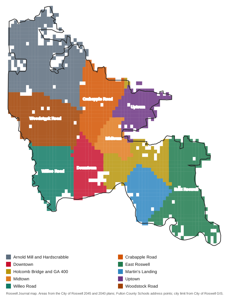
Map drawn by Roswell Journal from the Fulton County Schools address points, colored by area, with the city limit from the City of Roswell’s GIS data hub. Street maps of each area: © OpenStreetMap contributors.
The five Activity Centers
Downtown is the historic and civic center, from the Chattahoochee north along Atlanta Street and Canton Street past City Hall, with the Roswell Mill, the Town Square and most of the city’s small parks. Every address is zoned for Roswell High.
Midtown is the shopping district where Georgia 9 meets Holcomb Bridge Road and Crossville Road, anchored by Roswell Town Center. Half its addresses carry a unit number, the highest share in the city, and it has five supermarkets.
Uptown runs along Georgia 9 from Mansell Road past Hembree Road. The plan calls it the city’s primary job center; Wellstar North Fulton Hospital and Hembree Park are here, and nearly every address is zoned for Milton High.
Holcomb Bridge and Georgia 400 surrounds exit 7, from Grimes Bridge Road to Big Creek Park. The plan calls it “Roswell’s premier gateway” and names the Kimberly-Clark campus as its biggest redevelopment site. Five elementary zones meet here.
East Roswell is the east side from Eves Road to the river, with East Roswell Park, the East Roswell library and Centennial High. It has more addresses than any other area in this guide.
The residential areas
Martin’s Landing, named in the city’s 2040 plan, fills the wedge between Georgia 400 and Eves Road south of Holcomb Bridge Road, down to the river. It is zoned entirely for Centennial High.
Woodstock Road is the west side along Georgia 92, which the city’s plans call Parkway Village, with Roswell North Elementary, Crabapple Middle and Lake Charles Park.
Willeo Road is the southwest corner by the river, with Willeo Park and the Chattahoochee Nature Center; only 2% of its addresses carry a unit number.
Crabapple Road is north-central Roswell around Sweet Apple Park, split almost evenly between the Milton High and Roswell High zones.
Arnold Mill and Hardscrabble is the northwest, with Roswell High and Leita Thompson Memorial Park. Part of it is in the plan’s Estate Residential area, most of which the plan says is not served by sewer.
Getting around
Each area guide gives the nearest Georgia 400 exit, the distance to City Hall and the distance to Hartsfield-Jackson Atlanta International Airport, measured on the OpenStreetMap road network with the OSRM routing engine. They range from about 32 to 35 miles to the airport. MARTA’s schedule data shows bus stops in four areas: route 85 along Georgia 9 between downtown and the Mansell park-and-ride, and route 185 through Midtown, Uptown and the Holcomb Bridge Road and Georgia 400 area to the Windward park-and-ride. Both run south to North Springs station. The county and the neighboring cities are in Roswell, Fulton County and the neighbors.
How we built this
- The areas. The five Activity Centers and their maps come from the city’s 2045 Comprehensive Growth Plan (pages 144 to 165). Woodstock Road follows the Parkway Village character area on the city’s map. Martin’s Landing, Willeo Road and Crabapple Road are areas the city’s 2040 plan names in its future development survey (pages 106 to 108). Arnold Mill is a place name in OpenStreetMap. We extended each to the neighborhoods around it so that the 10 areas cover the whole city; edges between areas follow main roads and are approximate.
- ZIP codes and school shares come from every Roswell address point inside each area in the Fulton County Schools map service, matched to the district’s 2025-26 zone map on Oct. 5, 2026.
- School scores are from the state’s 2025 School Grades data; home values from Zillow’s ZIP and city files for August 2026; stores, libraries and exit numbers from OpenStreetMap; parks from the city’s parks list.
- The city does not publish a neighborhood or homeowners association list we could find, so these pages do not list HOAs or name individual subdivisions beyond places OpenStreetMap names.
- We do not rank areas or say which suits whom. Every figure is linked so you can check it.
Frequently asked questions
What are the neighborhoods in Roswell?
The city’s 2045 plan names five Activity Centers: Downtown, Midtown, Uptown, Holcomb Bridge Road/GA 400 and East Roswell. This guide adds five residential areas the city’s plans and OpenStreetMap place on the map: Martin’s Landing, Woodstock Road, Willeo Road, Crabapple Road and Arnold Mill and Hardscrabble.
What ZIP codes are in Roswell?
Mainly 30075, west of the Georgia 9 and Holcomb Bridge Road area, and 30076, east of it. Parts of east Roswell use 30022, and small parts of the north use 30004 and 30009, ZIP codes shared with Johns Creek, Milton and Alpharetta.
What high schools serve Roswell?
Fulton County Schools zones 49% of Roswell addresses to Roswell High, 38% to Centennial High and 14% to Milton High, which is in the city of Milton. Zones do not follow city limits.
What is the typical home value in Roswell?
Zillow’s citywide figure was $653,146 in August 2026, up 1.26% on the year. By ZIP code it was $703,778 in 30075 and $582,171 in 30076. It is a modeled typical value, not a sale price.
Does MARTA serve Roswell?
Yes. Route 85 stops along Georgia 9 from downtown to the Mansell park-and-ride, and route 185 in Midtown, Uptown and near Holcomb Bridge Road and Georgia 400, according to MARTA’s schedule data. Both run to North Springs station.
Have your say